West Baldy Trail #94
✅ Field Verified: July 2026
7.2 MI
DISTANCE
1,857' / -65'
ELEVATION GAIN / LOSS
OUT & BACK or CONNECTOR
ROUTE TYPE
Baldy Wilderness
LOCATION
Trail Ratings
🥾🥾🥾🥾
DIFFICULTY
📍📍📍📍
REMOTENESS
🌄🌄🌄🌄🌄
SCENIC EXPERIENCE
🧭🧭
NAVIGATION
🌲🌲🌲
SOLITUDE
These ratings reflect real-world trail conditions in the White Mountains.
Difficulty measures physical effort. Remoteness, navigation, and solitude reflect the level of self-reliance required.
Map & Route
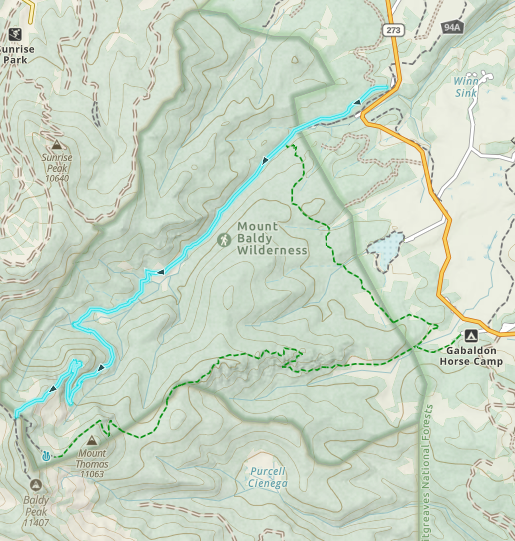
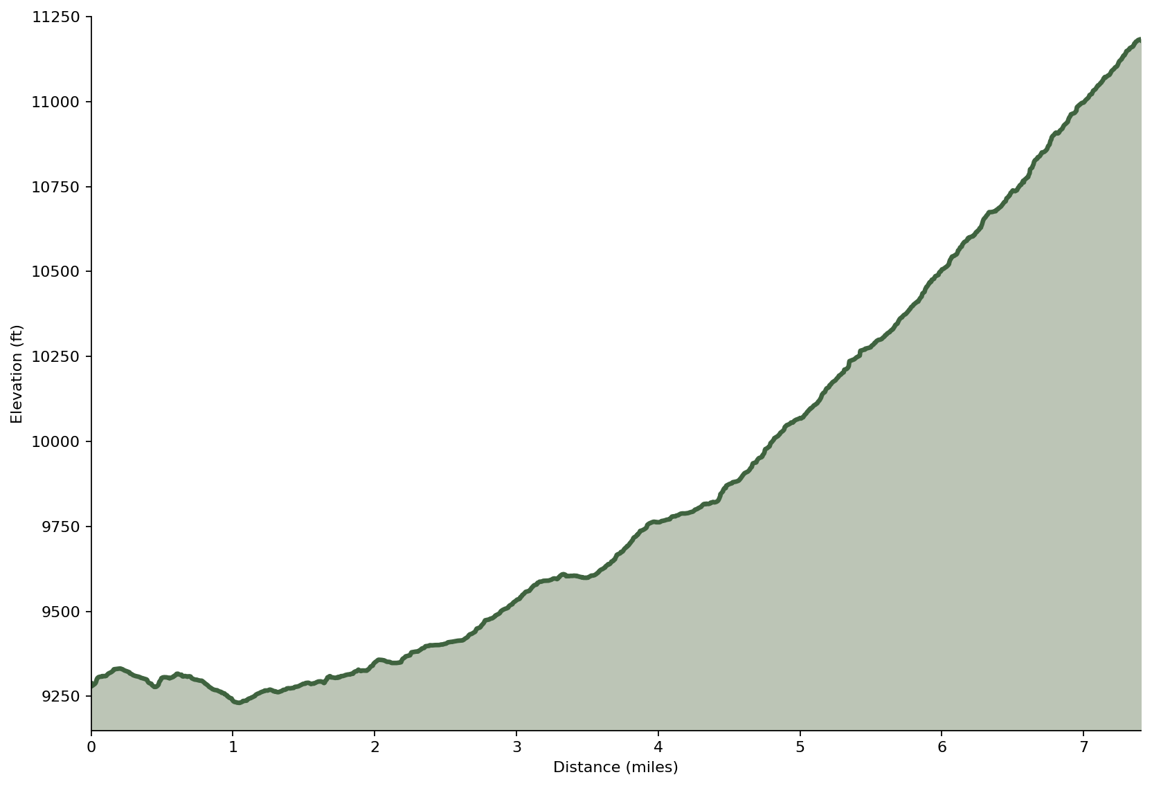
Field Verified Route: this GPS track was recorded and verified on the ground by Hike Southwest. Route details, conditions, and navigation notes are based on firsthand experience whenever possible.
Trail Overview
West Fork Baldy Trail is more than a hike—it's an opportunity to experience one of Arizona's finest wilderness landscapes. The trail follows a beautiful mountain stream before climbing through towering old-growth forest, vibrant meadows, and recovering burn areas on its way toward the upper reaches of Mount Baldy.
Recently reopened after years of dedicated volunteer stewardship, it offers a rewarding backcountry adventure for hikers seeking solitude, scenery, and a genuine connection to the White Mountains.
Trail Conditions
Trailhead to Crossover Trail Junction
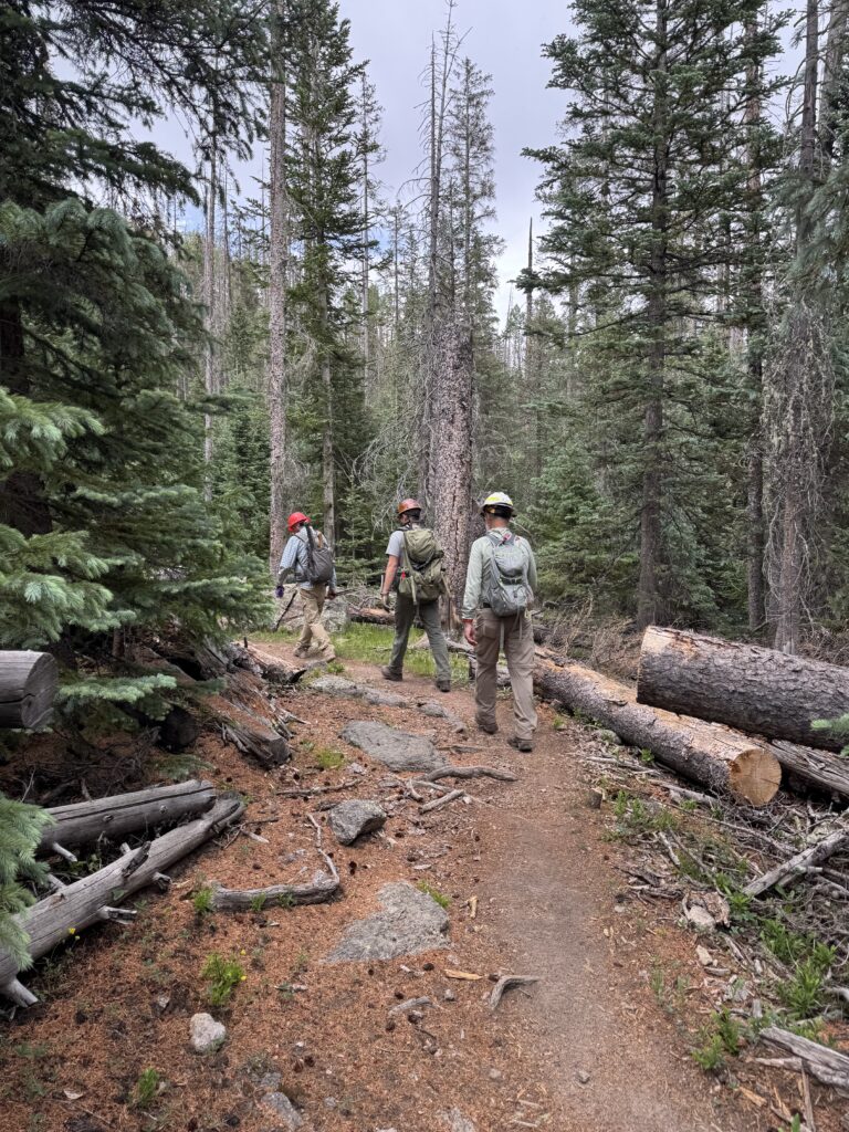
The trail begins on a wide, well-established path beneath a canopy of mixed conifers. The grade is gentle and easy to follow as it gradually descends toward the West Fork of the Little Colorado River. Early in the hike you'll pass through a mix of mature forest, offering a scenic prelude into the Baldy Wilderness.
At approximately 1.25 miles, you'll reach the signed junction with Crossover Trail #96. This connector provides access to the East Fork Trail and creates one of the premier backpacking and loop hiking opportunities in the Baldy Wilderness. Continuing straight keeps you on West Baldy Trail toward Mount Baldy.
Along the West Fork
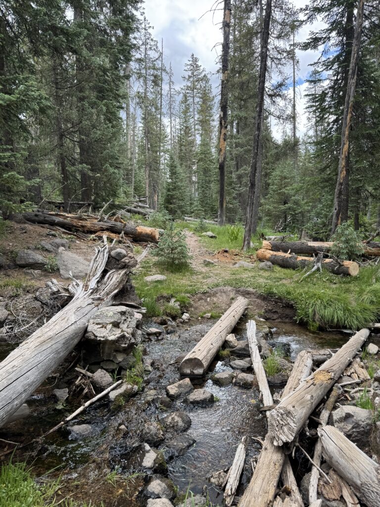
Beyond the junction, the trail settles into one of Arizona's finest streamside hikes. The route closely follows the West Fork through towering spruce, fir, and aspen forests, passing lush meadows, quiet pools, and some of the healthiest riparian habitats in Arizona.
The tread is generally well-defined with a mix of smooth forest floor, exposed roots, and occasional rocky sections. Grades remain gentle through much of this portion, making for enjoyable hiking as the trail gradually gains elevation.
The Creek Crossing
Approximately 4.5 miles from the trailhead, at roughly 9,500 feet, the trail crosses the West Fork for the only time along the route. For most of the hiking season, the crossing is straightforward using logs, rocks, or shallow water. During spring snowmelt, however, the creek can become swift and difficult to cross without getting wet.
Beyond the creek, the trail leaves the valley floor and begins the long, steady climb to the summit of Mount Baldy.
The Summit Climb
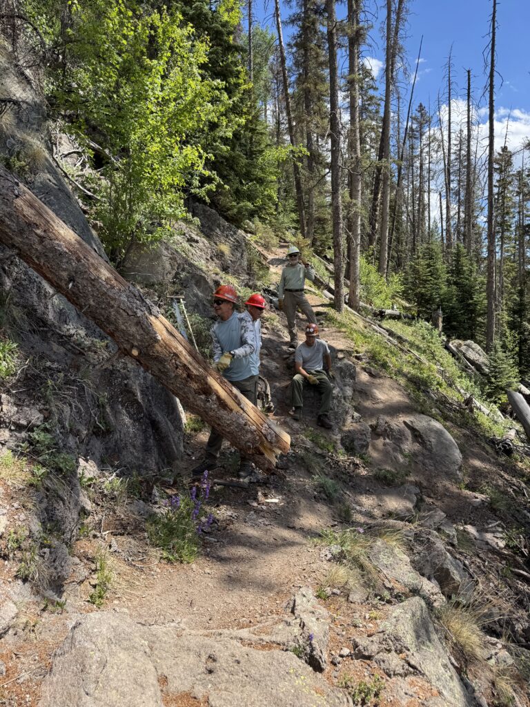
From the creek crossing onward, the trail becomes noticeably steeper with sustained climbing on the side of the mountain through dense spruce and fir forest. Long switchbacks steadily gain elevation with very few extended breaks in the grade. Although the tread remains easy to follow, this section demands considerably more effort than the lower miles and has a few sections of overgrowth.
As elevation increases, air becomes thinner, temperatures become cooler, and afternoon thunderstorms can develop quickly during the summer months.
The Final Push
The final miles continue climbing with few opportunities for relief before reaching the terminus of Mount Baldy West Fork Trail (11,184 feet). Near timberline, expansive views open across the White Mountains, rewarding hikers with one of Arizona's highest and most memorable wilderness destinations.
Terminus
The maintained trail ends near the summit of Mount Baldy (11,409 feet). While some mapping applications, including Gaia GPS, may display a route continuing beyond this point, hikers should be aware that the terrain beyond the maintained trail enters the adjacent White Mountain Apache Reservation.
Public access beyond this point requires permission from the White Mountain Apache Tribe. Please respect the reservation boundary and remain on public lands unless you have obtained the necessary authorization.
While the maintained summit itself offers only limited views, the reward of this hike comes from the journey, following the West Fork through one of Arizona's finest mountain valleys before climbing into the cool spruce and fir forests of the state's highest wilderness. It's a trail remembered less for a single destination than for the remarkable landscape experienced along the way.
Current Conditions
Last Surveyed: July 2026
By: Hike Southwest / Alpine Trail Stewards
Tread Condition
Good
Blowdown
None known
Water
Reliable until after creek crossing - treatment required before drinking
Signage
Limited beyond trailhead
Hazards
Seasonal flooding/mud, exposed roots and rocks
Passability
Hiker — Yes
Stock — Yes
Access & Trailhead
📍 Trailhead GPS
33.96480', -109.50138
🌲Apache National Forest / Springerville Ranger District
Mount Baldy Wilderness
🏕️ Trailhead Facilities
Vault toilet
🚗 Access Route
East of Alpine off Forest Road 249/Hwy 273 west of Big Lake
🅿️ Parking
Paved with horse trailer parking
📵 Cell Service
None
❄️ Seasonal Access
High-elevation snow and seasonal road closures may limit access well into the spring.
🏔 Nearest Town
Alpine
Help Keep Trail Information Current
Encountered a downed tree or major obstacle? Share what you found so other hikers can plan accordingly and help us identify trails that may need attention.
Gear Notes
- Supportive hiking shoes or lightweight boots with good traction are recommended
- Trekking poles are highly recommended for the sustained upper climb and descent.
- Water filter or purifier for treating water before drinking.
- Rain jacket or hiking umbrella for summer monsoon showers.
- Pack extra layers—temperatures can be much cooler near the summit.
- Satellite communicator (such as a Garmin inReach® or similar) is recommended.
Safety Notes
- High elevation and the long climb can make this hike more strenuous than expected.
- Spring runoff may make the West Fork crossing difficult or impassable.
- Afternoon thunderstorms develop quickly during the summer monsoon season.
- Remote location with extended emergency response times.
Trail Story
More than a climb to Arizona's highest wilderness, West Baldy is a story of old-growth forests, relentless volunteer stewardship, and the people determined to keep this remarkable trail open. Follow the trail and discover the story.
🧭 Adventure Begins with Preparation
Every trail has its own challenges, and conditions can change quickly. A little planning goes a long way. Before heading out, take a few moments to prepare, understand the risks, and make informed decisions for a safer, more enjoyable adventure.