Escudilla National Recreation Trail #308
✅ Field Verified: August 2026
3 MI
DISTANCE
1,204' / -29'
ELEVATION GAIN / LOSS
OUT & BACK
ROUTE TYPE
ESCUDILLA WILDERNESS
LOCATION
Trail Ratings
🥾🥾🥾
DIFFICULTY
📍📍📍📍
REMOTENESS
🌄🌄🌄🌄🌄
SCENIC VALUE
🧭🧭
NAVIGATION
🌲🌲🌲🌲
SOLITUDE
These ratings reflect real-world trail conditions in the White Mountains.
Difficulty measures physical effort. Remoteness, navigation, and solitude reflect the level of self-reliance required.
Map & Route
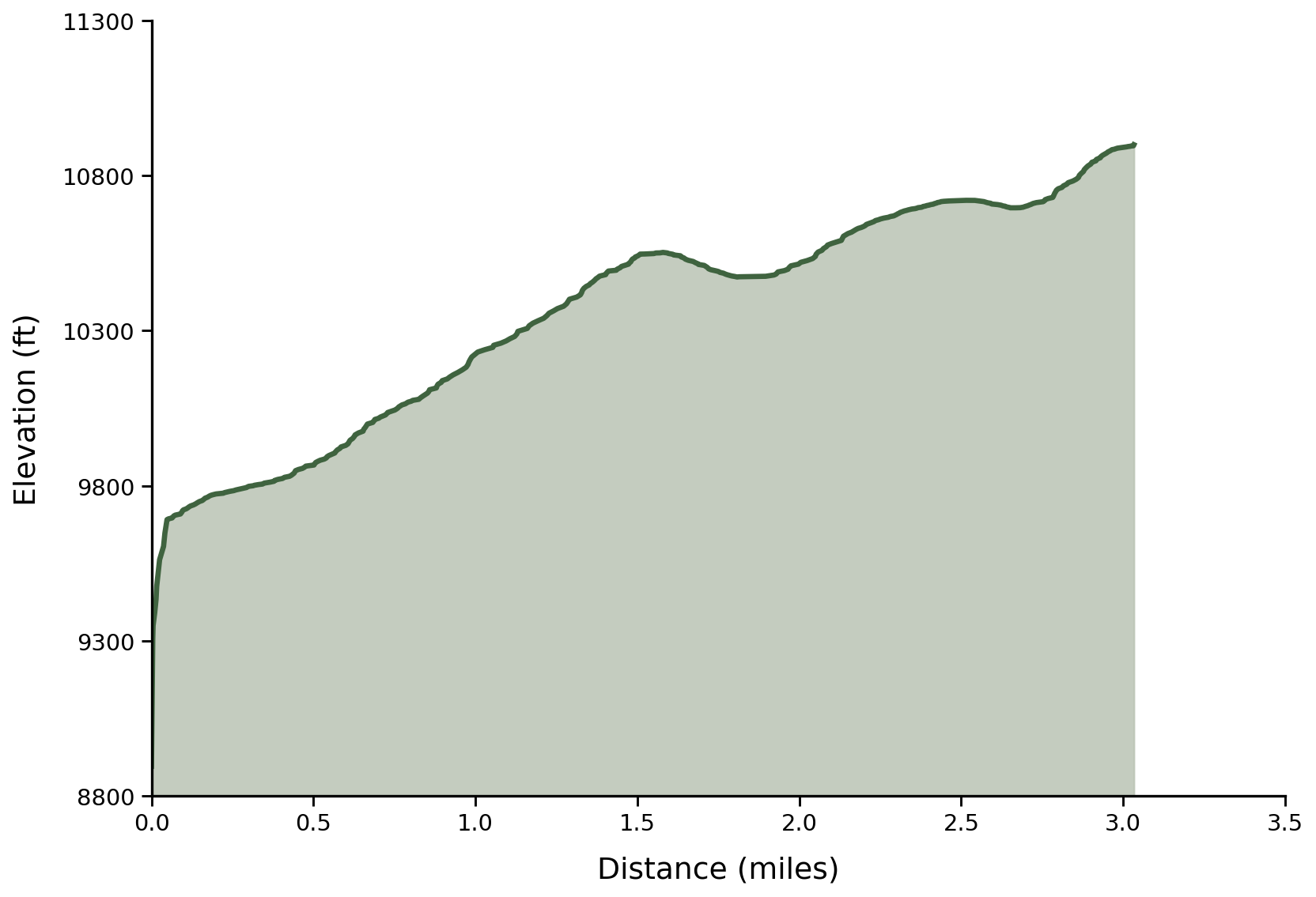
Field Verified Route: this GPS track was recorded and verified on the ground by Hike Southwest. Route details, conditions, and navigation notes are based on firsthand experience whenever possible.
Trail Overview
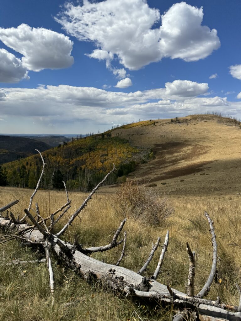
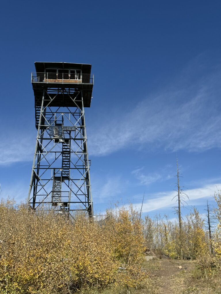
Escudilla Fire Tower Trail is a rewarding mountain hike that climbs through vibrant aspen groves, mixed conifer forest, and open ridgelines to the historic fire tower atop one of Arizona's highest peaks. Along the way, hikers are treated to sweeping views of Terry Flat, Mount Baldy, and the distant mountains of New Mexico while experiencing a landscape shaped by both wildfire and renewal.
The trail follows a well-defined tread with a steady, moderate climb, making it an excellent choice for hikers looking for a scenic half-day adventure. Designated a National Recreation Trail, it combines beautiful forest, expansive vistas, and a fascinating glimpse into the White Mountains' natural and cultural history.
Although the ascent is continuous, the grade remains manageable for most hikers with a reasonable level of fitness. Loose volcanic rock on some steeper sections can make footing challenging, particularly on the descent.
Trail Conditions
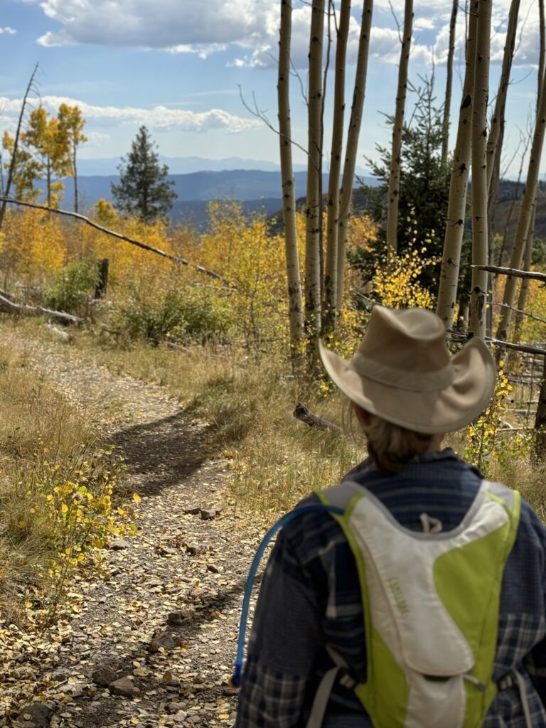
The trail begins with a steady climb while entering beautiful stands of young aspen regenerating after the Wallow Fire. The tread is well established and easy to follow, climbing gradually on a series of gentle grades with occasional roots and embedded rock.
Aspen Forest
As the climb continues, the grade becomes more sustained while remaining comfortable for most hikers. Loose volcanic rock and scattered stones become more common underfoot, requiring a bit more attention, particularly on the descent. Occasional openings in the forest provide expanding views across Terry Flat and into New Mexico.
Toolbox Draw
The trail alternates between narrow singletrack and short remnants of an old logging road while continuing its steady climb toward the ridge. The forest gradually opens, revealing sweeping views across Toolbox Draw then of Mount Baldy, and ultimately distant mountains stretching into New Mexico. This section is generally the steepest portion of the hike.
Profanity Ridge
After reaching the top of Profanity Ridge, the trail briefly descends into an open meadow where it intersects with the Government Trail #119 at the low spot before making a steady climb up the other side and out of the meadow.
Final Saddle
Leaving the meadow you'll begin to taper your climb before dropping into the final saddle below the historic Escudilla Fire Tower. From the saddle the climb through dense aspen regeneration to the upper mountain is more exposed to wind and weather, with expansive views in nearly every direction. Recent stewardship work has helped improve the corridor for both hikers and equestrians.
Fire Tower
As the trail rounds its final switchback, the summit comes into view beyond regenerating aspen. Standing beside the historic fire tower, you're rewarded with an almost airplane-like perspective of the White Mountains, where forests, meadows, ridges, and distant peaks seem to stretch endlessly toward the horizon. It's the kind of place that invites you to pause, catch your breath, and simply take it all in before beginning the hike back down.
Current Conditions
Last Surveyed: July 2026
By: Hike Southwest / Alpine Trail Stewards
Tread
Clear to fire tower
Blowdown
One known tree down just past Profanity Ridge currently making equestrian access challenging
Water
None
Signage
Signed at key locations
Hazards
Loose volcanic rock, Steady climb, High elevation, Wind exposure, Summer lightning
Passability
Hiker — Yes
Stock — Can be challenging in current condition beyond Profanity Ridge
Access & Trailhead
📍 Trailhead GPS
33.91977, -109.11713
🌲Apache National Forest / Alpine Ranger District
Escudilla Wilderness
🏕️ Trailhead Facilities
None
🚗 Access Route
Forest Road 8056 via US 191
🅿️ Parking
Small roadside parking area
📵 Cell Service
None at trailhead, spotty higher up
❄️ Seasonal Access
Winter conditions may limit access
🏔 Nearest Town
Alpine / Nutrioso
Help Keep Trail Information Current
Encountered a downed tree or major obstacle? Share what you found so other hikers can plan accordingly and help us identify trails that may need attention.
Gear Notes
- Trekking Poles are highly recommended for the sustained climb and descent.
- Footwear with good traction is recommended for the rocky, uneven tread.
- Carry plenty of water, as there are no reliable water sources along the trail.
- A lightweight wind layer and Hiking Umbrella are recommended for sun exposure on upper ridge and summit.
Safety Notes
- Weather can change rapidly at nearly 11,000 feet, especially during the summer monsoon season.
- Lightning is a serious hazard on the exposed ridgeline and summit - descend to lower elevations if thunderstorms develop.
- Loose volcanic rock can make footing unstable, particularly on the descent.
- Strong winds are common near the summit and can create rapidly changing conditions.
- Emergency response times may be extended due to the remote, high-elevation location.
This post contains affiliate links. We may earn a small commission at no additional cost to you. Thank you for supporting Hike Southwest and the trails we love.
Trail Story
Escudilla NR Trail is more than a climb to a fire tower. It’s a journey through the scars of wild fire, high ridgelines, and one of the most unforgettable viewpoints in eastern Arizona.
🧭 Adventure Begins with Preparation
Every trail has its own challenges, and conditions can change quickly. A little planning goes a long way. Before heading out, take a few moments to prepare, understand the risks, and make informed decisions for a safer, more enjoyable adventure.