
Reno Trail #65
✅ Field Verified: June 2026
1.9 MI
DISTANCE
0' / -990'
ELEVATION GAIN / LOSS
OUT & BACK or CONNECTOR
ROUTE TYPE
Bear Wallow Wilderness
LOCATION
Trail Ratings
🥾🥾🥾🥾
DIFFICULTY
📍📍📍📍
REMOTENESS
🌄🌄🌄🌄
SCENIC EXPERIENCE
🧭🧭
NAVIGATION
🌲🌲🌲🌲
SOLITUDE
These ratings reflect real-world trail conditions in the White Mountains.
Difficulty measures physical effort. Remoteness, navigation, and solitude reflect the level of self-reliance required.
Map & Route
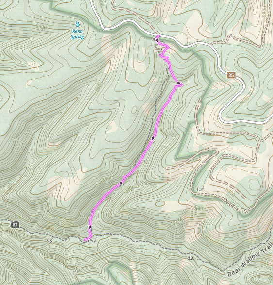
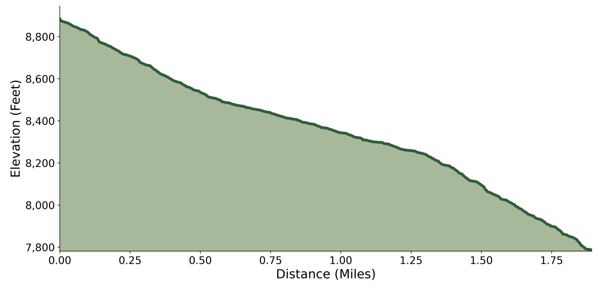
Field Verified Route: this GPS track was recorded and verified on the ground by Hike Southwest. Route details, conditions, and navigation notes are based on firsthand experience whenever possible.
Trail Overview
The Reno Trail is one of the quickest gateways into the heart of the Bear Wallow Wilderness. It wastes little time leaving civilization behind, dropping through towering forests into a rugged creek drainage where solitude, old-growth trees, and wild country define the experience.
This is one of the most remote hikes in eastern Arizona, where self-reliance is essential and the reward isn't a single destination, but the feeling of being immersed in one of the state's last truly wild places.
Trail Conditions
Trailhead to 0.5 Mile
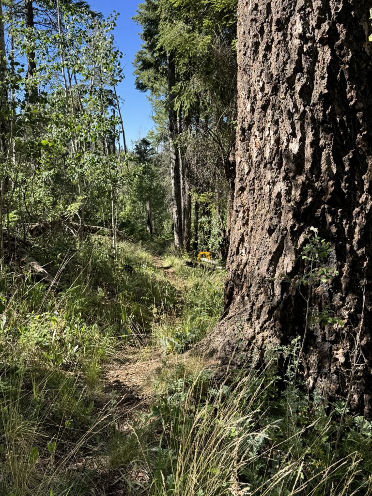
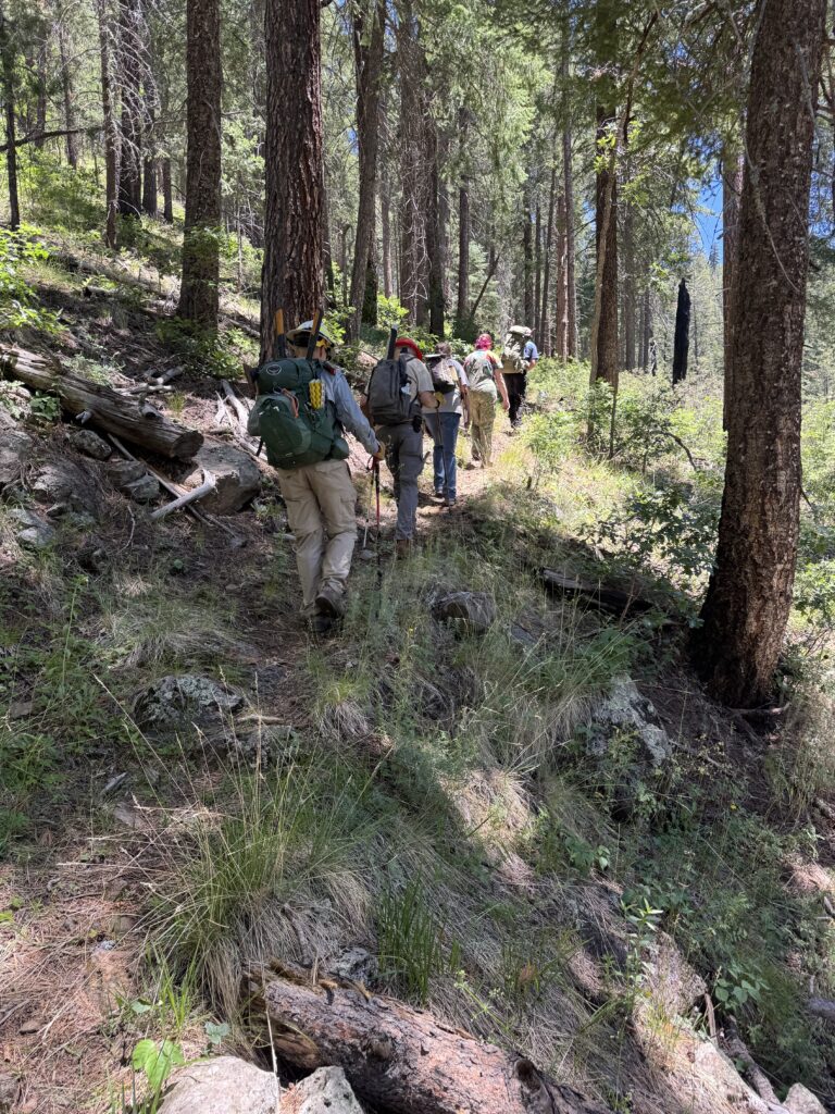
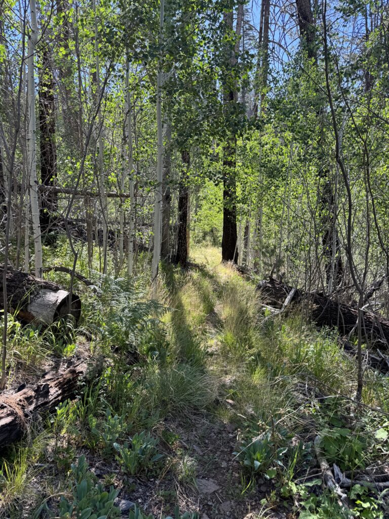
The Reno Trail begins with an immediate descent through a mixed conifer forest of ponderosa pine, Douglas-fir, white fir, and aspen. The tread is well-defined and easy to follow as a series of switchbacks begins the steady drop toward Bear Wallow Creek.
0.5 to 2 Miles
The descent continues through increasingly rugged terrain as the trail winds down the mountainside. Numerous switchbacks help manage the grade, but hikers should still expect a sustained downhill of just under 1,000 feet.
Along the way stands an enormous white fir that has long served as one of the trail's defining landmarks. Though now standing dead, its immense trunk and towering stature remain a striking reminder of the old-growth forest that once thrived throughout the Bear Wallow Wilderness.
Approximately 2 Miles
The trail reaches the bottom of the drainage where the character of the hike changes noticeably. Grades become gentler as the route follows the drainage toward Bear Wallow Creek beneath a dense forest canopy. During wetter periods, portions of the trail may be damp or muddy.
Final Stretch
The Reno Trail ends at its junction with Bear Wallow Trail (#63), providing access to additional exploration both upstream and downstream through the heart of the wilderness. This junction makes Reno an excellent access trail for longer day hikes, backpacking trips, or simply experiencing one of the most secluded corners of eastern Arizona.
Current Conditions
Last Surveyed: July 2026
By: Hike Southwest / Alpine Trail Stewards
Tread Condition
Good
Blowdown
None known
Water
None reliable along trail, carry what you'll need
Signage
Limited beyond trailheads
Hazards
Seasonal flooding/mud, exposed roots and rocks
Passability
Hiker — Yes
Stock — Yes
Stewardship Report
6/20/26 — Removed 7 downed trees & brushed back overgrowth
Access & Trailhead
📍 Trailhead GPS
33.61679', -109.42387
🌲Apache National Forest / Springerville Ranger District
Bear Wallow Wilderness
🏕️ Trailhead Facilities
None
🚗 Access Route
South of Alpine on Hwy 191 turn west on Road 25 to trailhead
🅿️ Parking
Small roadside gravel area
📵 Cell Service
None
❄️ Seasonal Access
High-elevation snow and seasonal road closures may limit access well into the spring.
🏔 Nearest Town
Alpine
Help Keep Trail Information Current
Encountered a downed tree or major obstacle? Share what you found so other hikers can plan accordingly and help us identify trails that may need attention.
Gear Notes
- Supportive hiking shoes or lightweight boots with good traction are recommended
- Trekking poles for the sustained climb and/or descent.
- Rain jacket or hiking umbrella for summer monsoon showers.
- Satellite communicator (such as a Garmin inReach® or similar) is recommended.
Safety Notes
- Remote location with extended emergency response times.
- Steep, sustained climb on the return hike.
- Weather can change rapidly, especially during summer monsoons.
- Patches of poison ivy possible along the trail's lower half
This post contains affiliate links. We may earn a small commission at no additional cost to you. Thank you for supporting Hike Southwest and the trails we love.
Trail Story
The Bear Wallow Wilderness isn't simply remote - it's a place that changes the way you experience the outdoors. Follow the trail into one of Arizona's wildest landscapes and discover the story behind this remarkable wilderness.
🧭 Adventure Begins with Preparation
Every trail has its own challenges, and conditions can change quickly. A little planning goes a long way. Before heading out, take a few moments to prepare, understand the risks, and make informed decisions for a safer, more enjoyable adventure.